

Illustrated Maps
Concept Maps
Small towns. Dungeons. Events.
Be it temporary or historic, real or imaginary, every hand-drawn concept map brings any place to life.
Adventure Maps
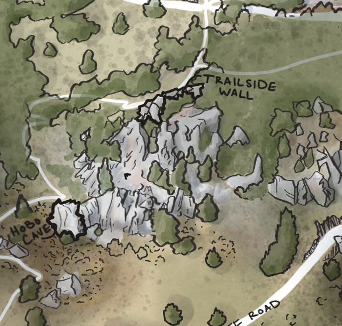
Flagstaff Mountain Bouldering map
Boulder, CO
As any climber will tell you, getting to the crag is 300 times harder if you don't know where you're going. The problem can be compounded by poor directions, incorrect coordinates, and just not knowing what to look for.
These illustrated maps highlight roads, trails, parking, and landmarks an adventurer might need to know get to their destination.
Purely aesthetic, these maps can serve as an art piece at home, a front page insert for guidebooks, or even as a badly folded resource to toss in the glove compartment of your van before heading to the crag. Even the newest of gumbies will get to where they need to go with these maps.
Maps can be customized by area - large or small - and the size of the map can be customized for final publication (Guidebook? Poster? Postcards?). We'll work with you to identify the landmarks and need-to-knows based on the needs of the area.
Formats include hard copy (posters, and fabric, wood, or metal prints) and digital maps.
Other themes may include skiing, hiking, rafting rapids, mountain biking trails, fishing spots, and more.
