

Maps
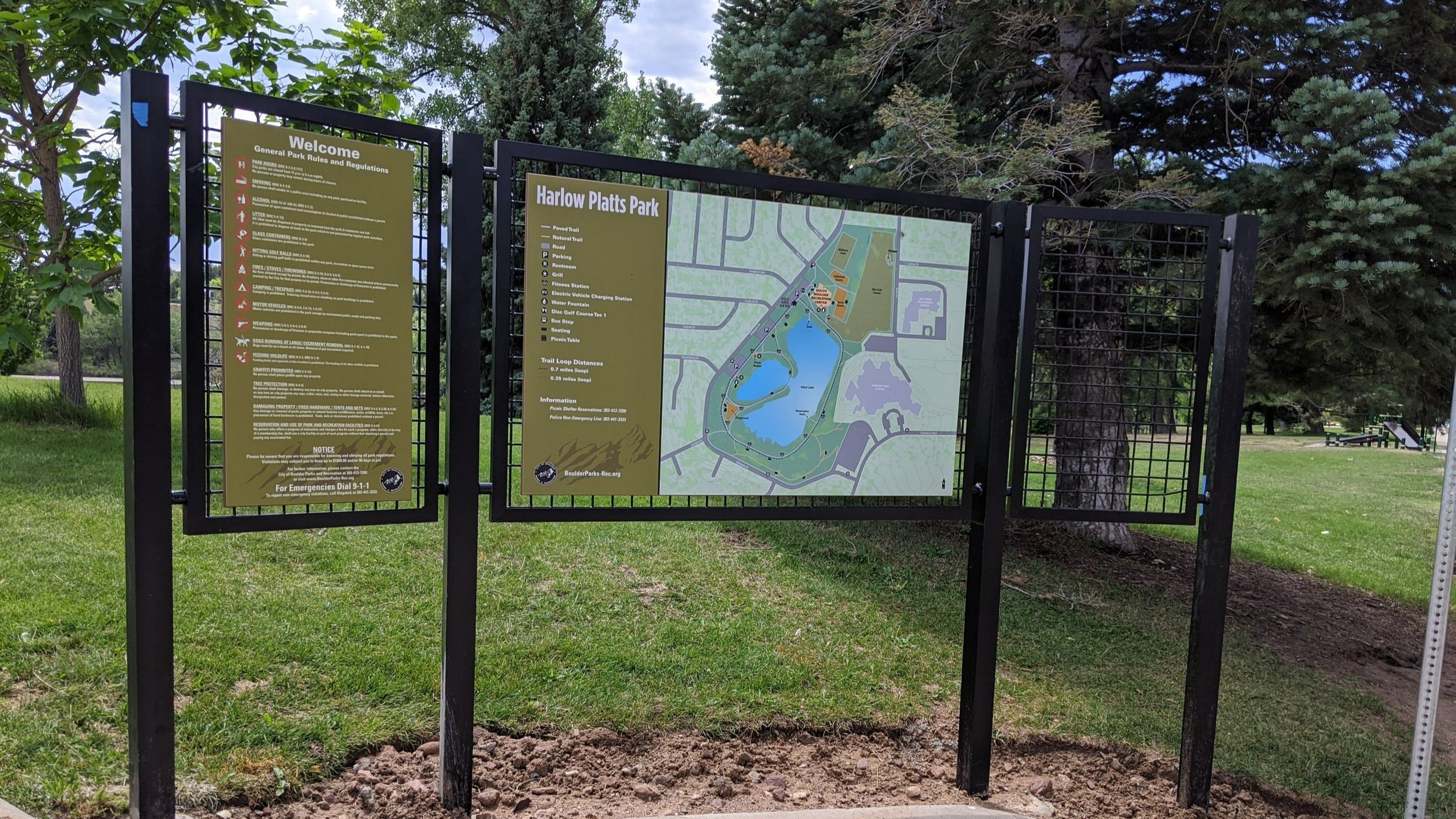
Map at Harlow Platts Park, Boulder, CO
To make a truly good map, it should be attractive, accurate, and accessible.
Our maps are made using GIS to show details with accuracy, and then enhanced with Adobe Illustrator for the colors and effects that will bring it to life.
They feature colors, contrast, and textures that make them readable for those with vision difficulties or color blindness, as well as universal symbols that are understandable for those who do not speak English.
Maps can be customized to accommodate your branding and accessibility needs, as well as any local policy requirements.
Formats include hard copy (sign panels, posters, and flyers) and digital maps.

Boulder Reservoir - North Shore Trailhead Map (created while working as staff for Boulder Parks and Recreation)
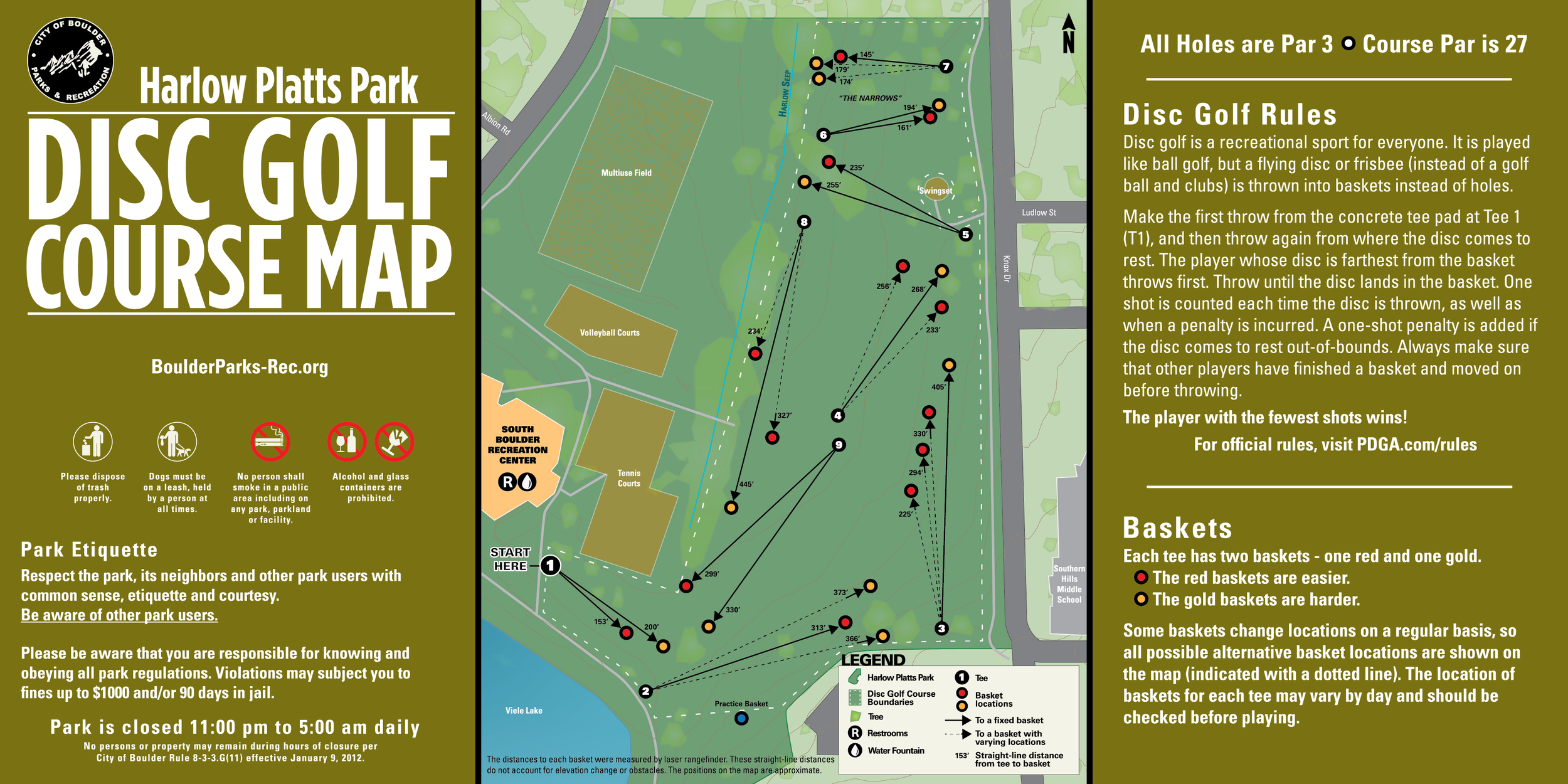
Harlow Platts Park Disc Golf Course Map - (created while working as staff for Boulder Parks and Recreation)

Boulder Reservoir - Coot Lake Trailhead Map (created while working as staff for Boulder Parks and Recreation)

Harlow Platts Park Map (created while working as staff for Boulder Parks and Recreation)
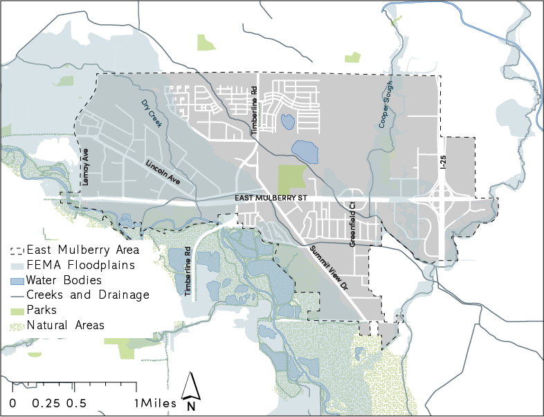
Flooding and Natural Resources Map for the East Mulberry Plan (created for graduate school capstone project).
Existing Plan Guidance Map for the East Mulberry Plan (created for graduate school capstone project).
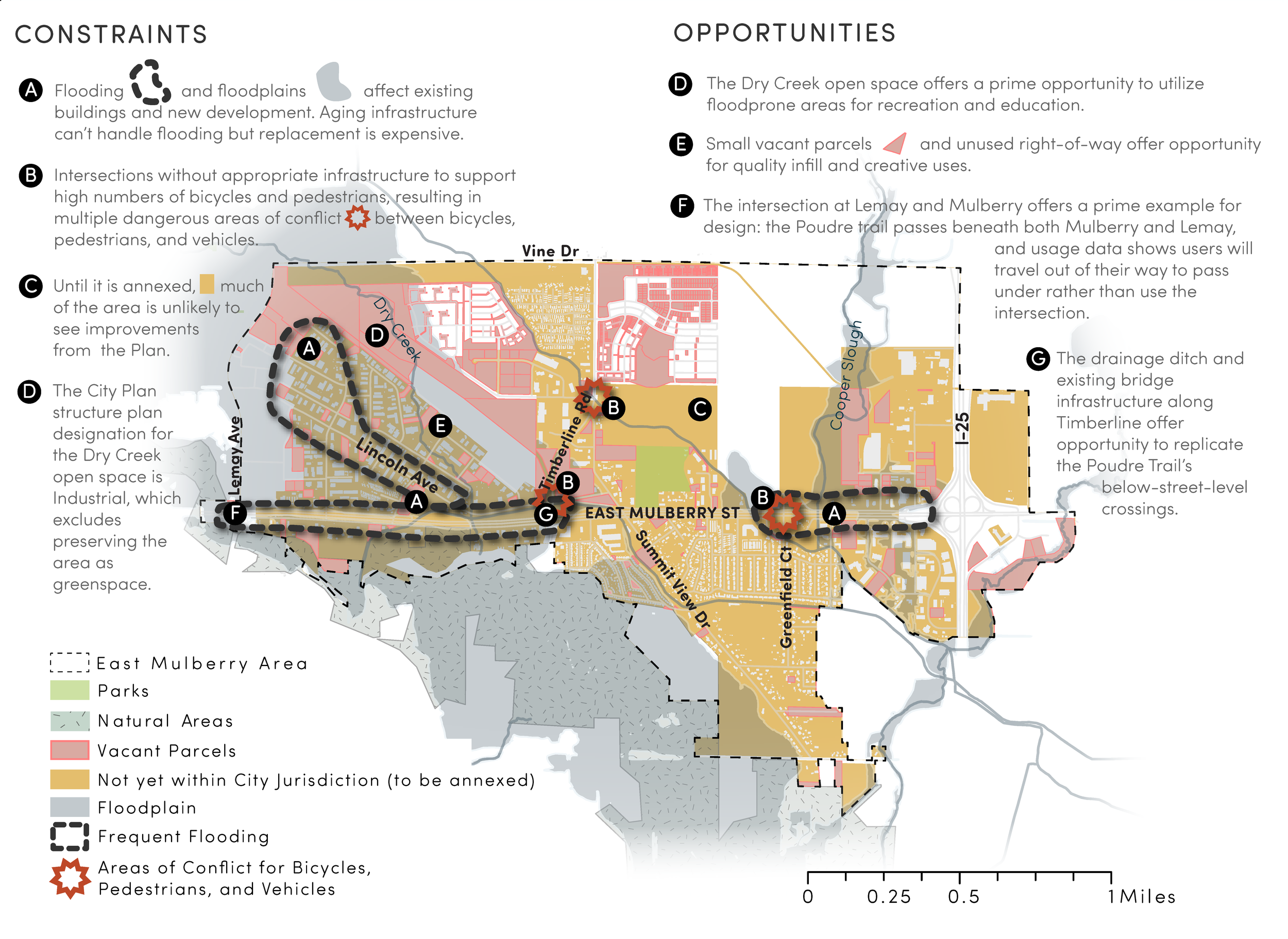
Constraints and Opportunities Map for the East Mulberry Plan (created for graduate school capstone project).
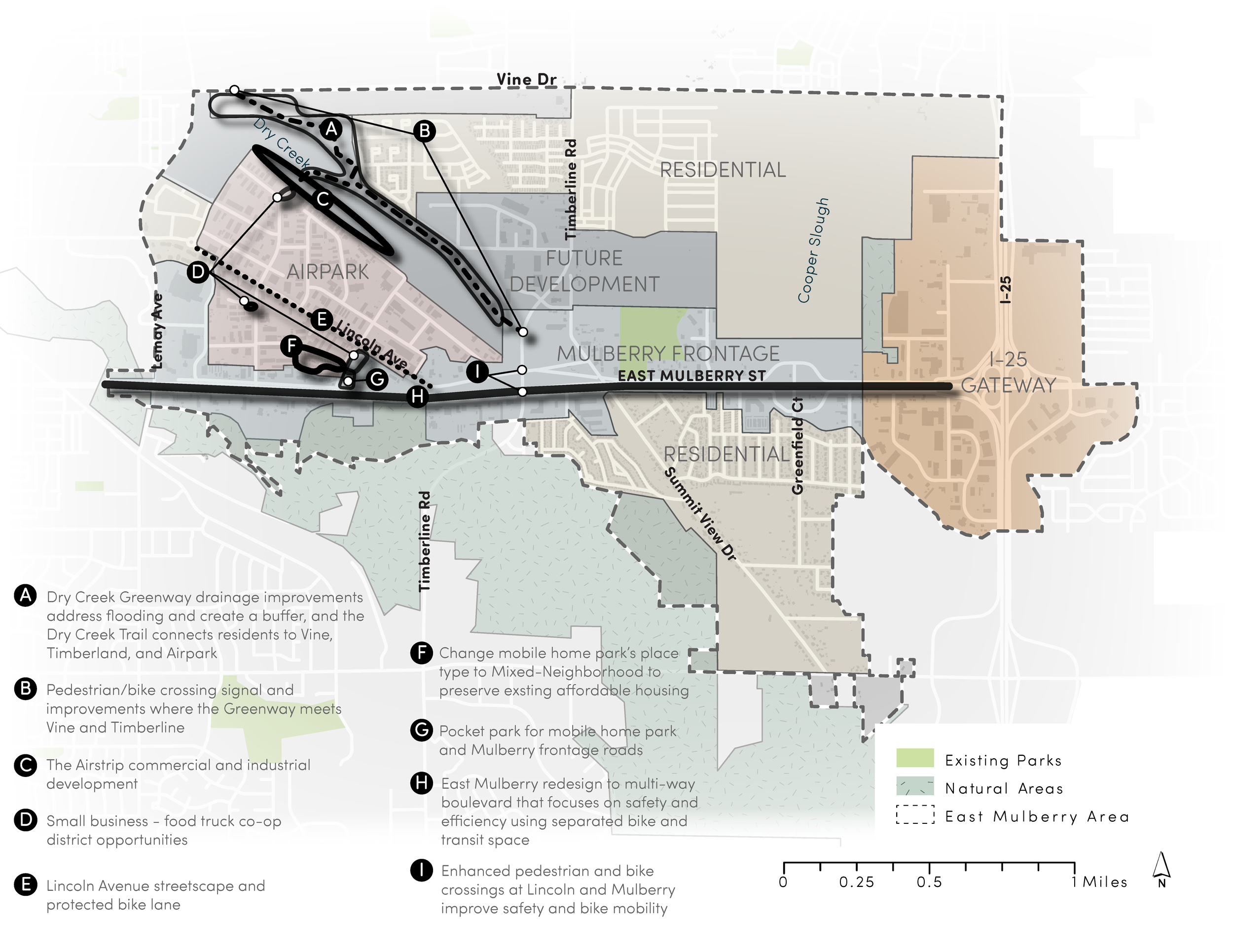
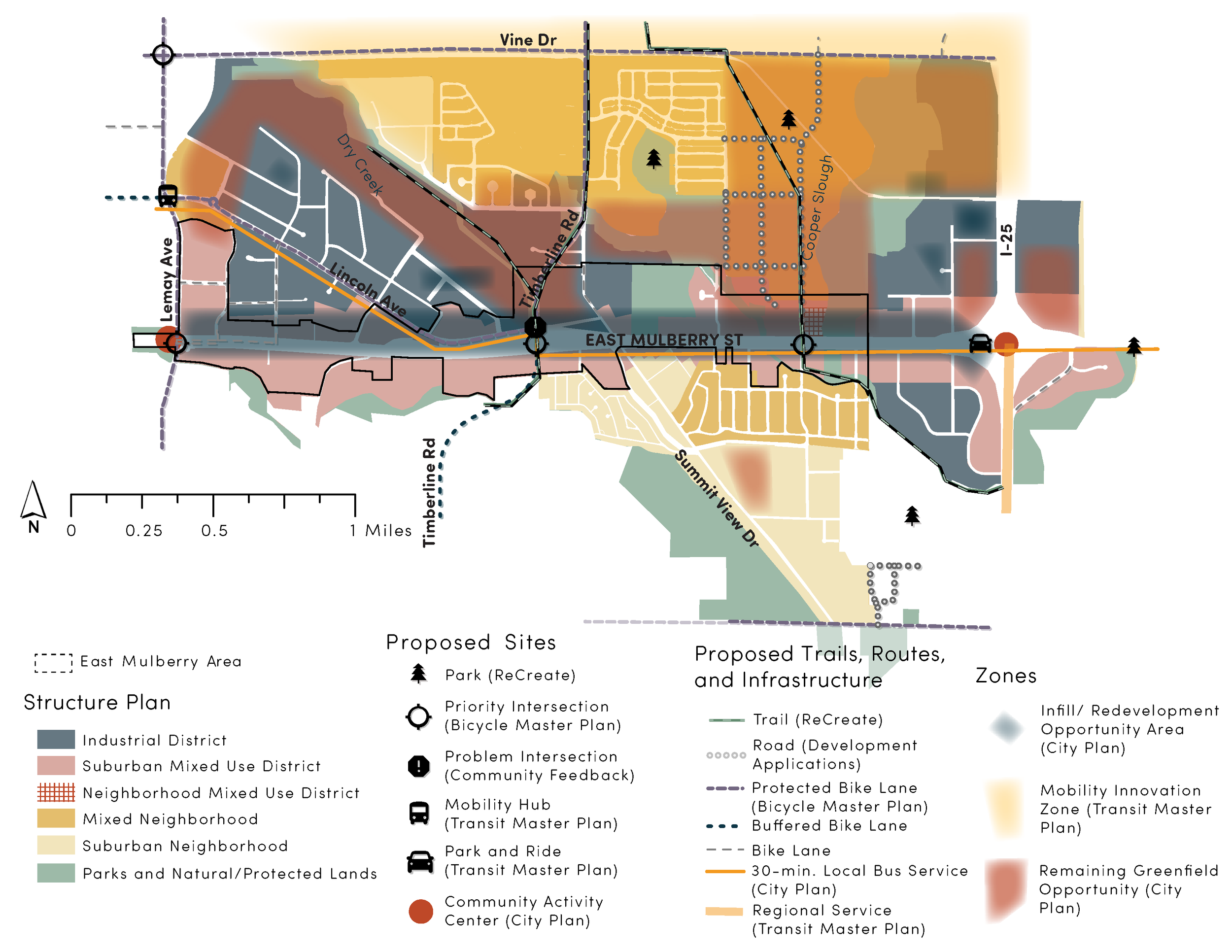
Capstone Recommendations Map for the East Mulberry Plan (created for graduate school capstone project).
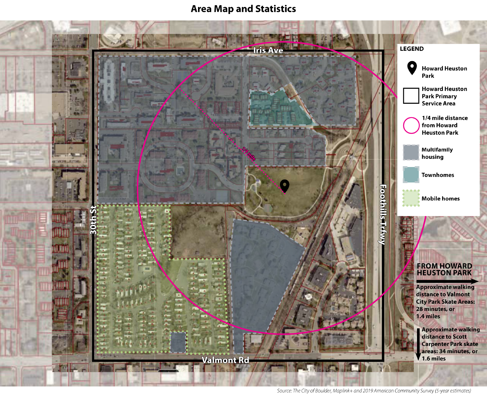
Howard Heuston Park Area Map (created while working as staff for Boulder Parks and Recreation)
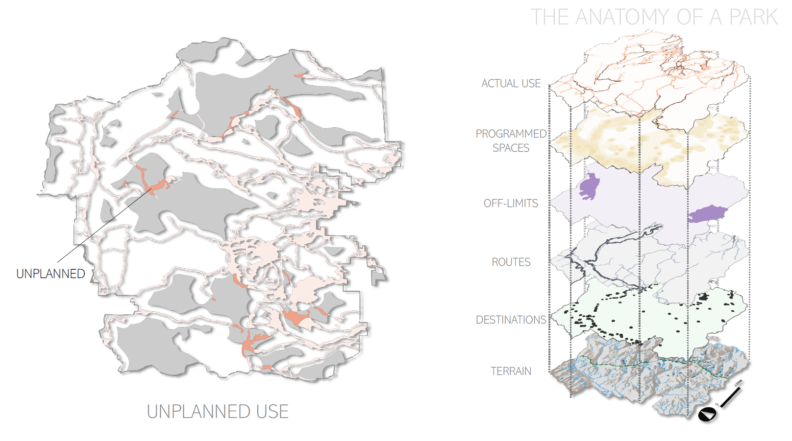
Rocky Mountain National Park - Areas of Unplanned Use (created as a graduate student at CU Denver)
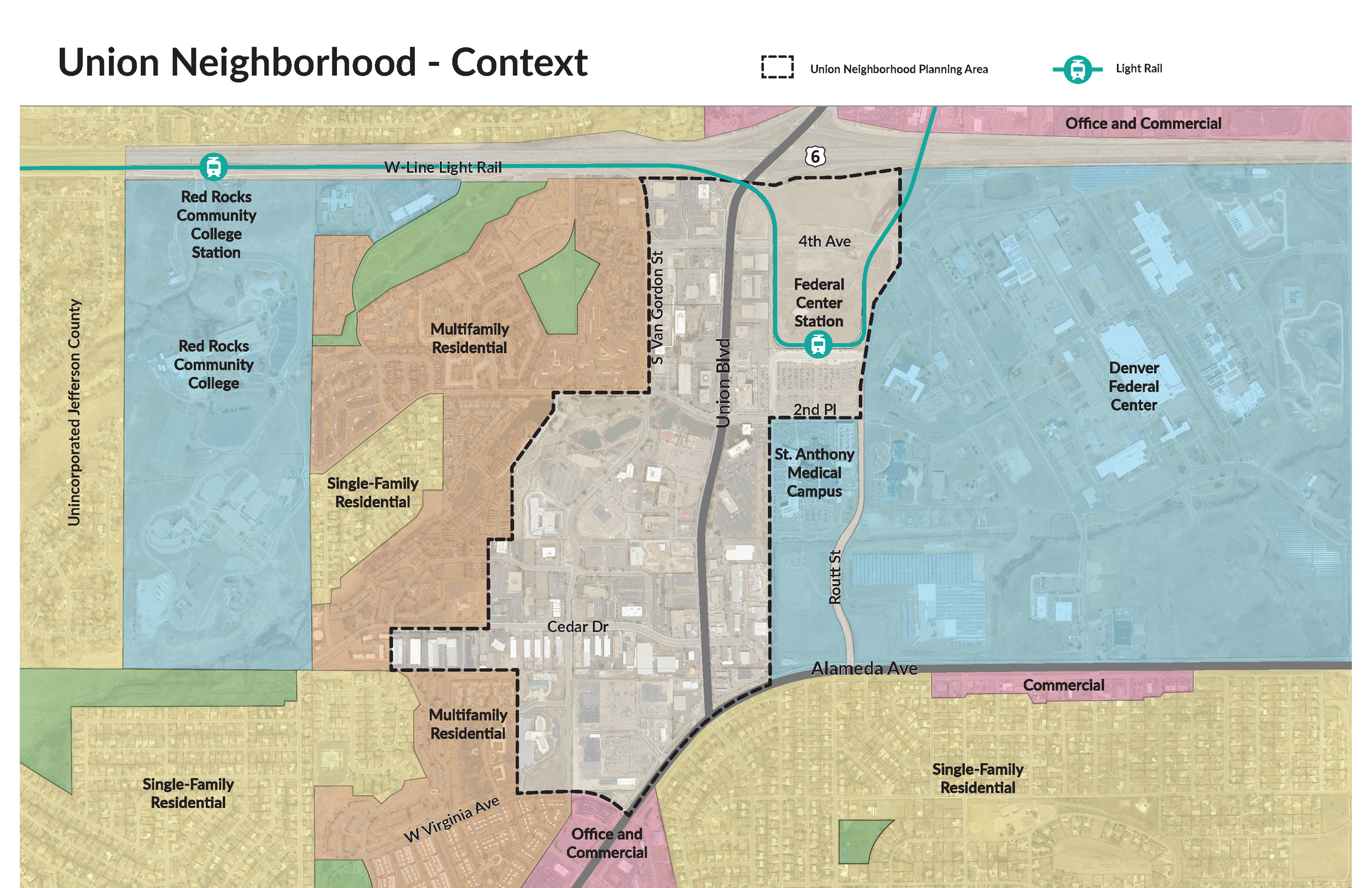
Union Neighborhood Context Map for the Union Neighborhood Vision Plan (created while working as staff for the City of Lakewood)
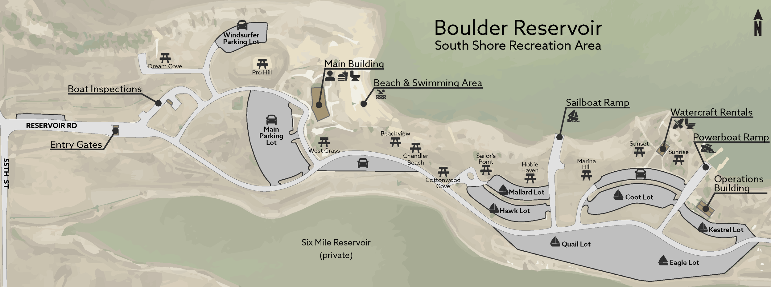
Boulder Reservoir South Shore Simple Online Map (created while working as staff for Boulder Parks and Recreation)